

Key Takeaways
New Zealand's Geography
New Zealand is an archipelago in the southwestern Pacific Ocean made up of two main landmasses — the North Island and the South Island — plus hundreds of smaller islands. Its landscapes are extraordinarily varied because the country sits on the boundary of the Australian and Pacific tectonic plates, producing volcanoes, earthquakes, fjords, and mountain ranges within a relatively compact area. This tectonic activity, combined with millions of years of isolation from other continents, has created ecosystems and landforms found nowhere else on Earth.
New Zealand straddles the Pacific Ring of Fire, where the Indo-Australian and Pacific plates collide — a process that continues to reshape its terrain through ongoing volcanism and seismic activity.
Two Islands, One Dramatic Collision
New Zealand's extraordinary scenery is not an accident of aesthetics — it is the direct result of geology in action. The country occupies a stretch of the Pacific Ring of Fire where the Indo-Australian Plate and the Pacific Plate grind against each other continuously. On the South Island, this collision has pushed the Southern Alps skyward; on the North Island, the same forces feed a chain of volcanoes that remain active today.
What makes New Zealand particularly striking is the speed of transition. A traveler can move from geothermal mud pools to glaciated peaks within a single day's drive — a compression of geological extremes that few places on Earth can match. Compare this with similarly dramatic destinations: our guide to Patagonia's remote landscapes explores how South America's far south also owes its character to tectonic forces, though it lacks New Zealand's volcanic dimension.
3,724 m
Height of Aoraki/Mount Cook
New Zealand's tallest peak, formed by the ongoing collision of the Indo-Australian and Pacific plates.
~80M years
Duration of New Zealand's isolation
New Zealand separated from the supercontinent Gondwana roughly 80 million years ago, driving its unique biodiversity.
7+ meters
Annual rainfall in Fiordland
Milford Sound receives over 7 meters of rain per year, making it one of the wettest inhabited places on Earth.
14
Active or potentially active volcanoes
GeoNet, New Zealand's geological hazard monitoring agency, tracks 14 active or potentially active volcanoes across the country.
The North Island: Fire and Thermal Energy
The North Island's defining geographic feature is the Taupo Volcanic Zone — a rift system stretching from the Bay of Plenty in the northeast to Ruapehu in the center. Lake Taupo itself occupies the caldera of a supervolcano that last erupted catastrophically around 1,800 years ago, making it one of the most powerful eruptions in recorded human history. Today the lake appears serene, but the region's geothermal heartbeat is unmistakable at Rotorua, where sulfuric steam vents, boiling mud pools, and geyser fields are part of everyday life.
Tongariro National Park, a UNESCO dual World Heritage site, protects the Central Plateau's three volcanic peaks and holds deep cultural significance for the Māori people, who regard these mountains as sacred ancestors. Visitors should always consult the GeoNet volcanic alert system and the Department of Conservation before hiking in active volcanic terrain.
Check Volcanic Alerts Before You Go
New Zealand's GeoNet website publishes real-time volcanic alert levels for all active areas, including Tongariro, Ruapehu, and Whakaari/White Island. The Department of Conservation also posts current track closures and hazard warnings. Always verify conditions before planning any visit to geothermally active zones — conditions can change quickly.
The South Island: Ice, Alps, and Fjords
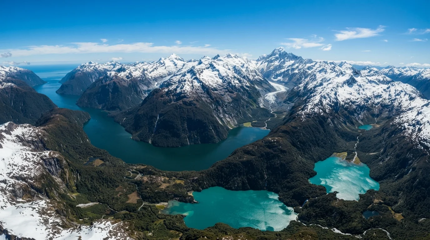
Where the North Island burns, the South Island was shaped by ice. The Southern Alps run nearly the full length of the island, with Aoraki/Mount Cook rising to 3,724 meters (12,218 feet) as the country's highest peak. On the western flank, glaciers like Franz Josef and Fox push down toward rainforest — a collision of climatic zones that feels almost surreal. The east side of the Alps creates a dramatic rain shadow, giving the Canterbury Plains their dryer, pastoral character.
Fiordland, in the island's southwest, preserves the legacy of the last Ice Age. Ancient glaciers carved U-shaped valleys to depths of hundreds of meters; when sea levels rose, the ocean flooded them to create fjords with near-vertical walls of Precambrian rock. Milford Sound — technically a fjord despite its name — receives over seven meters of rain annually, feeding dozens of temporary waterfalls that streak its cliff faces after every storm.
Isolation as a Geographic Force
Geography is not only about landforms — it is also about what grows and lives there. New Zealand's 80-million-year separation from Gondwana allowed evolution to proceed on its own track. With no land mammals (aside from two bat species) until human arrival, birds filled ecological niches that elsewhere belong to ground-dwelling creatures. The result was a suite of flightless birds — kiwi, kakapo, weka — and towering trees like the kauri that exist nowhere else in the world.
This biological uniqueness is itself a landscape-level phenomenon. Ancient podocarp forests and the silver-leafed tī kōuka (cabbage tree) give New Zealand's valleys a visual grammar entirely their own. It is a place where the living landscape is as geographically distinctive as the rock beneath it.