

Key Takeaways
Patagonia
Patagonia is a vast, sparsely populated region occupying the southern tip of South America, shared between Argentina and Chile. It encompasses an extraordinary variety of terrain — Andean peaks, glaciers, windswept steppes, fjords, and sub-Antarctic forests — across roughly 400,000 square miles. The region has no single political boundary; "Patagonia" is a geographic and cultural designation rather than a formal administrative unit.
The Argentine portion is generally defined as the area south of the Río Colorado, while Chilean Patagonia begins around the Los Lagos region and extends south through Magallanes to Tierra del Fuego.
A Region Bigger Than Most Countries
When travelers talk about "going to Patagonia," they're describing a destination roughly the size of Texas and California combined — a region so vast that it contains genuine ecological extremes within a single journey. The Argentine side is dominated by open steppe: wind-scoured grasslands where guanacos roam against a backdrop of flat-topped mesas. Cross the Andes into Chile, and the landscape transforms into a labyrinth of fjords, channels, and temperate rainforest fed by relentless Pacific moisture.
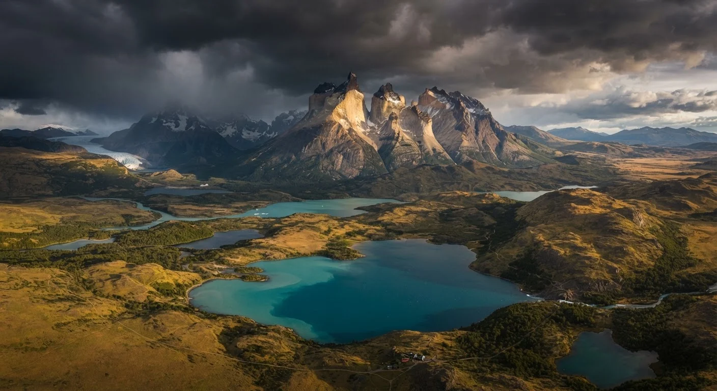
The Andes themselves are the defining geographic spine. In Patagonia, they're younger and more jagged than their northern counterparts, still actively shaped by glacial erosion. That erosion has carved the region's most iconic silhouettes: the three granite spires of Torres del Paine in Chile, and the Fitz Roy massif near Argentina's El Chaltén.
For travelers who love landscapes shaped by raw geological forces, Patagonia delivers in ways that are genuinely hard to overstate — though it's worth comparing notes with equally dramatic destinations. New Zealand's fjords and volcanic plateaus offer a useful counterpoint for understanding what makes each region visually singular.
~400,000
Square miles in the Patagonian region
Geographers and travel sources consistently estimate Patagonia's total area at roughly 400,000 square miles across Argentina and Chile.
2
Major Patagonian ice fields outside polar regions
The Southern and Northern Patagonian Ice Fields together constitute the largest temperate ice mass outside Greenland and Antarctica.
19 stories
Height of Perito Moreno Glacier's ice face
The glacier's terminal face rises approximately 170–240 feet above the surface of Lago Argentino, depending on the section measured.
Glaciers, Ice Fields, and Living Ice
At the heart of Chilean and Argentine Patagonia lie two immense ice fields — the Southern Patagonian Ice Field and the smaller Northern Patagonian Ice Field — which together form the largest temperate ice mass outside the polar regions. Dozens of glaciers flow outward from these reserves, calving into lakes, rivers, and fjords.
The most visited is Argentina's Perito Moreno Glacier, a UNESCO World Heritage site within Los Glaciares National Park. Unlike most glaciers worldwide, Perito Moreno is considered relatively stable rather than in rapid retreat, though visitors and researchers note that this status warrants continued observation rather than assumptions about its future. Enormous blue-white ice walls rise up to 19 stories above the surface of Lago Argentino, and periodic rupture events — when the glacier's advancing edge dams the lake and then dramatically collapses — are among the most spectacular natural events travelers can witness.
For those drawn to experiencing glaciated coastlines from the water, Patagonia's southern channels are also a gateway to expedition-style voyaging. Expedition cruises operating in these waters follow very different protocols from mainstream sailings, and understanding those differences helps set realistic expectations.
Layer Up — Even in Summer
Patagonian weather can shift from sunny and calm to driving rain and 50 mph winds within an hour. Pack a waterproof outer shell, insulating mid-layer, and moisture-wicking base layer regardless of the season you're traveling in. Experienced trekkers recommend keeping rain gear accessible at the top of your pack, not buried at the bottom.
Cultural Roots: People Before the Postcard
Long before Patagonia became a travel destination, the region was home to indigenous peoples whose histories stretch back thousands of years. The Tehuelche (also known as the Aónikenk) were the semi-nomadic hunters of the Argentine steppe, renowned among early European explorers for their stature and endurance. The Mapuche, whose territory historically spanned both sides of the Andes, remain one of South America's largest indigenous groups, with significant cultural presence in northern Patagonia today.
European settlement, driven by sheep ranching and resource extraction from the 19th century onward, profoundly altered indigenous ways of life and land access. This history is essential context for any visitor — Patagonia's wide-open spaces are not "empty" landscapes; they carry layered human meaning that deserves acknowledgment and curiosity.
Towns like Puerto Natales (Chile), El Calafate and El Chaltén (Argentina) serve as modern gateways, each with its own character. Puerto Natales has evolved from a quiet wool-shipping port into a hub for trekkers heading to Torres del Paine. El Chaltén, founded only in 1985, bills itself as Argentina's trekking capital and remains refreshingly low-key given the world-class trails on its doorstep.
Planning a Trip: What to Know Before You Go
Patagonia rewards preparation. The distances between highlights are enormous — it's roughly 600 miles by road from El Calafate to the tip of Tierra del Fuego — and transport options thin out quickly beyond the main gateways. Internal flights exist between major hubs, but they're subject to weather-related cancellations that can cascade through an itinerary.
Weather deserves its own honest assessment. The region's position in the "Roaring Forties" and "Furious Fifties" latitude bands means persistent westerly winds that can gust above 60 mph in open areas. Experienced hikers plan for all four seasons in a single day and layer accordingly. The unpredictability is part of the experience, but it's not something to romanticize unprepared.
Trekking permits for popular routes in Torres del Paine — including the famous "W Trek" and the full circuit — must often be secured months in advance during the peak season. Camping spots inside the park are assigned, not first-come. Entry requirements, permit systems, and park regulations are subject to change, so verifying details through official park and government channels before you book is genuinely important, not just boilerplate caution.
For a structured approach to destination research that covers entry requirements, safety advisories, and cultural preparation, the pre-trip research checklist is a helpful starting framework before committing to any itinerary.